
Cadastre Committee Representative Participates in the “EUROCARTO 2026” International Conference

From 8 to 11 September 2026, the “EUROCARTO 2026” International Conference, organized by the International Cartographic Association (ICA), was held in Brno, Czech Republic. The conference was attended by Narek Kroyan, Chief Specialist of the Geodesy and Cartography Division, Geodesy and Land Management Department of the RA Cadastre Committee.
The conference addressed current trends in the development of cartography and geospatial information, modern approaches to geospatial data management, the development of national spatial data infrastructures, as well as opportunities for the application of artificial intelligence and innovative technologies.
The event also covered issues related to the processing and analysis of geospatial data, the automation of cartographic processes, digital and interactive cartographic services, web cartography, the use of three-dimensional geospatial data, virtual reality and digital twins, as well as ensuring the quality and interoperability of spatial data.
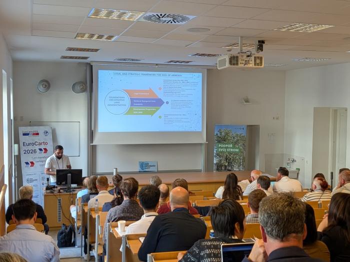
During the conference, Narek Kroyan delivered a presentation entitled “Features of the Armenian National Spatial Data Infrastructure Development”, prepared by the Cadastre Committee, presenting the work being carried out in the Republic of Armenia towards the development of the national spatial data infrastructure, as well as approaches and existing opportunities aimed at advancing the sector.
Participation in the conference provided an opportunity to learn about international best practices and modern technological solutions in the fields of cartography and geospatial information, while also contributing to the expansion of international professional cooperation and knowledge exchange.
